Miyagi
宮城県
Start here
What to know about Miyagi
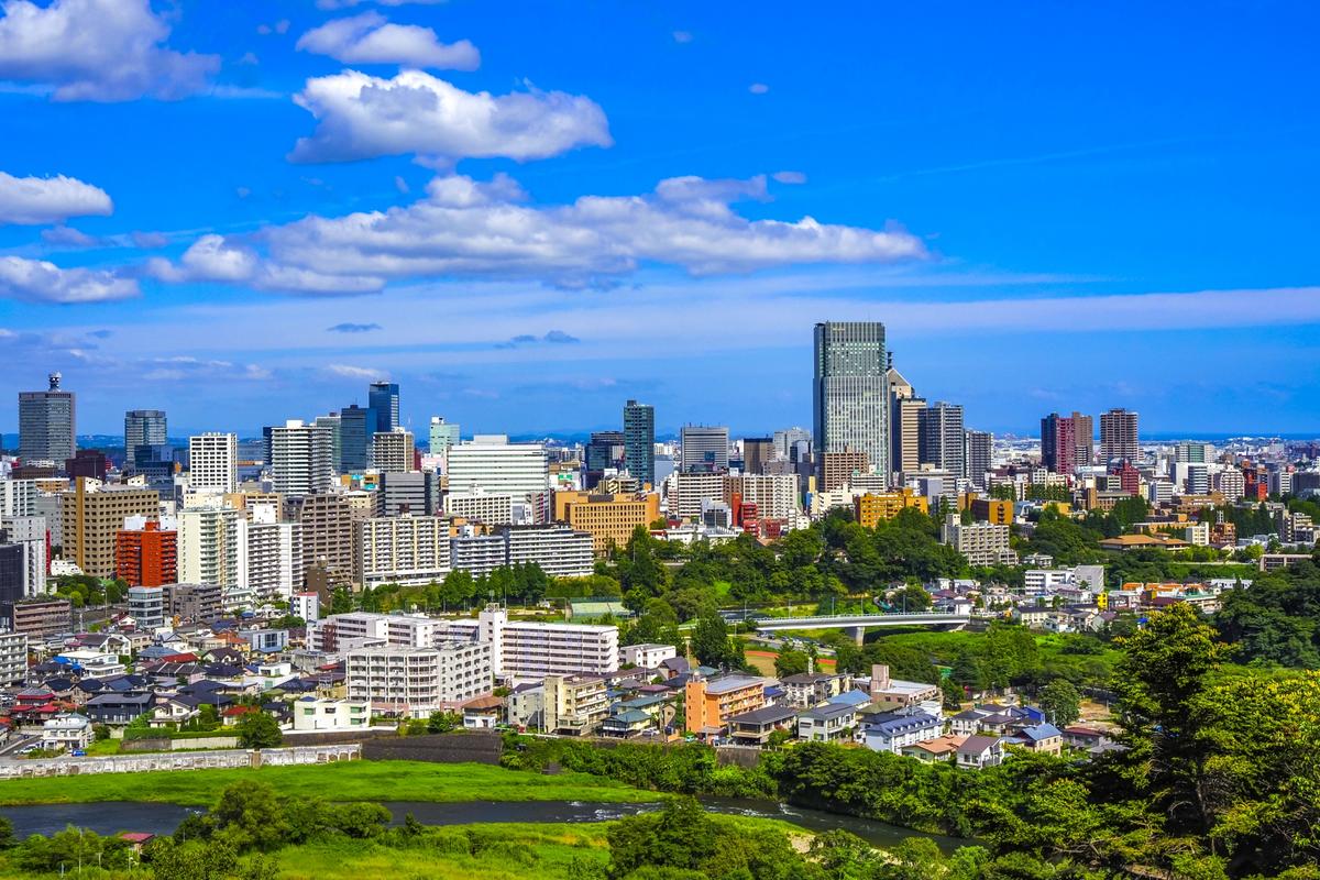
Miyagi is a prefecture you can take in across nature, history, and city walks all in a single day. The pine-dotted sea of Matsushima, one of the Three Views of Japan. The view from Aoba Castle, raised by Date Masamune. The Tanabata streamers that fill the summer night. The crater lake and frost-covered trees that change the face of Mt. Zaō from season to season. Step a little beyond Sendai and both the scenery and the pace of time shift in a way you can feel.
Matsushima
Matsushima Bay holds some 260 islands of various sizes. Wind and waves have carved the pines and rocky cliffs over long centuries, and their shadows layer across the surface of the sea. Up on the surrounding hills are four lookouts known as the Shidaikan, named Sōkan, Reikan, Yūkan, and Ikan, each offering the islands from a different angle. Seen from the water, the view is something else again. Sightseeing boats wind through the islands and bring you close to sheer cliffs and to narrow openings that only the smallest boats can pass through.
Watching over the bay is Zuigan-ji Temple. Date Masamune rebuilt this Rinzai Zen temple over five years, from 1604 to 1609, and its main hall and kitchen building are designated National Treasures. The nearby Godaidō Hall has an even longer story behind it. According to tradition, Sakanoue no Tamuramaro founded a Bishamon hall on the site in 807, and that hall is said to be the origin of Godaidō. The current building was put up by Masamune in 1604 and is one of the oldest examples of Momoyama-period architecture surviving in Tōhoku. The twelve zodiac animals are carved in openwork beneath the eaves, and circling this small hall that juts out over the sea while looking for your own zodiac sign has long been part of the fun of a visit.
Sendai Castle Ruins
Sendai Castle Ruins stand on Mt. Aoba at an elevation of about 130 meters, on the site of a mountain castle. From the main bailey, the view opens out across the streets of Sendai all the way to the Pacific. The castle was built without a tenshu tower from the start, designed around its everyday palace and stone walls, so what greets you today is the high stone ramparts and a broad bailey site that together convey the scale of the original. At the edge of the bailey stands an equestrian statue of Date Masamune. The image of him on horseback, one eye narrowed as he looks down over the city, has become a beloved symbol of Sendai.
Sendai Tanabata Matsuri
The Sendai Tanabata Matsuri, or Star Festival, is a summer festival held each year from August 6 to 8. It is counted among the three great festivals of Tōhoku, alongside Aomori's Nebuta and Akita's Kantō. The tradition is said to have grown from a custom encouraged in the Edo period by Date Masamune, who wanted to promote the sewing and calligraphy skills of young girls. Today, it has grown into a summer scene where huge bamboo decorations fill the arcaded shopping streets stretching out from Sendai Station. Streamers in every color hang overhead, turning the arcades into a tunnel of paper, and simply walking through is enough to feel as though you have stepped right into the festival.
Okama and the Zaō Snow Monsters
The Zaō Range, rising along the border between Miyagi and Yamagata, wears two faces, volcanic in nature and a deep winter mountain. Cradled between Mt. Kattadake and Mt. Kumanodake is a crater lake known as Okama. It measures roughly 325 meters across, about 1 kilometer around, and 27.6 meters at its deepest point. The color of the water shifts between blue, green, and emerald depending on the day and the season, which is why it is also called Goshikinuma, the Five-Colored Lake. Step out of your car along the Zaō Echo Line and a short climb brings you to a view of pale green water opening up below. The lake is visible only from around late April to early November, between the seasons of melting and returning snow.
In winter, Zaō transforms into a mountain of frost-covered trees. Across the slopes at elevations of about 1,300 to 1,700 meters, Aomori firs are coated with wind-driven water droplets and snow that freeze in place, turning the trees into human-shaped white figures that fill the hillsides. The same range looks different on each side. On the Miyagi side, the masses of snow and ice lean forward in rough, jagged rows, a more rugged sight. The viewing season runs from January to February, and at night the trees are lit up, with rows of figures standing along the slopes in a pale blue glow.
Tashirojima
Tashirojima, sitting off the coast of Ishinomaki, is a small island measuring 2.92 square kilometers and about 11.5 kilometers around. It is famous for being a place where cats outnumber people, the so-called "Cat Island." There are only two settlements, Ōdomari to the north and Nitoda to the south, and in the middle of the island stands a quiet little shrine called Neko-jinja, built by fishermen who prayed for good catches. Walk along the sloping paths and cats step out from beneath the eaves of houses or from the edges of the harbor, crossing in front of you as if you were the one who happened to wander into their territory.
Getting there is straightforward. Ferries from Ishinomaki Port reach Ōdomari in about 40 minutes and Nitoda in about 50 minutes, close enough for an easy day trip. Ishinomaki has long been associated with the manga artist Ishinomori Shōtarō, and the city has built much of its town planning around manga. As part of that effort, Tashirojima Manga Island opened on the island in April 2000. The lodges there were designed by Satonaka Machiko and Chiba Tetsuya. The scene of cats, a fishing harbor, and cabins designed by manga artists all sharing the same horizon makes for one of the more unusual travel destinations in Miyagi.
Where to go
Places to visit in Miyagi
Curated spots and experiences across Miyagi.
Shopping
3 places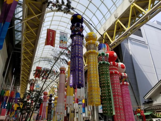


Zoom in
Areas in Miyagi
Neighborhoods and districts to explore

Location
Where is Miyagi?
Miyagi sits on the Pacific side of the Tōhoku region and has the largest population of any prefecture in Tōhoku. Its capital, Sendai, is the only city in Tōhoku designated as a government ordinance city, and it is divided into five wards: Aoba, Miyagino, Wakabayashi, Taihaku, and Izumi. As of January 2026, the city's population is roughly 1.09 million, and the prefecture as a whole counts about 2.21 million people as of April 2026. The total area is around 7,282 square kilometers, ranking 16th in Japan.
Sendai is also known as "Mori no Miyako," the City of Trees. The nickname goes back to the early Edo period, when the first feudal lord, Date Masamune, encouraged his retainers to plant fruit-bearing trees, bamboo, and cedars in their estates. The greenery that came to wrap the castle town gave rise to this image. In the Meiji era, the name was sometimes written with a different character meaning "forest." Many of the city's roadside trees were lost in the wartime fires, and the zelkova trees that line Jōzenji-dōri Avenue today were replanted in 1958. Walk down the avenue now and you are still passing beneath those same trees.
The land itself varies widely. The Ōu Mountains run along the western edge, with the Zaō Range, Mt. Funagata, and Mt. Kurikoma forming the prefectural border. In the center, the Sendai Plain stretches out, watered by the Abukuma and Kitakami rivers, making it one of the finest rice-growing regions in Tōhoku. The southern tip of the Sanriku Coast in the north is a deeply indented ria coastline. Kesennuma Bay, Onagawa Bay, and Matsushima Bay cut sharply into the land, and the way the inlets reach far inland has made the area a center of fishing and aquaculture. Miyagi shares its borders with Iwate to the north, Yamagata to the west, and Fukushima to the south.
The climate is what you would expect on the Pacific side. Summers in the lowlands are not as hot as those further inland, and winters in the plains see relatively little snow. The mountains to the west are a different story, with deep snow and the famous Zaō frost-covered trees that draw winter visitors. From early summer into the warmer months, a cold northeasterly wind called the yamase sometimes blows in from the Sea of Okhotsk and reaches the eastern parts of the prefecture. When it lingers, temperatures struggle to rise, and farmers have long watched it closely because it can change how the rice crop turns out.
Loading map...
Access
Getting to Miyagi
Visitors arriving from overseas usually land first at Sendai Airport, which straddles the cities of Natori and Iwanuma. Routes from Asia, chiefly South Korea and Taiwan, fly into Sendai, letting travelers reach the prefecture without passing through Tokyo. The Sendai Airport Access Line links the airport to the city center, reaching JR Sendai Station in about 17 minutes by rapid service or 25 minutes by local train.
For domestic travel, the Hayabusa service on the Tōhoku Shinkansen connects Tokyo and Sendai in as little as 1 hour and 32 minutes. From the Osaka area, a transfer between the Tōkaidō Shinkansen and the Tōhoku Shinkansen at Tokyo Station puts you in Sendai in around 4 hours 30 minutes to 5 hours. At Sendai Station, the shinkansen, conventional lines, subway, and bus terminals are all gathered in the same building, making transfers easy even for first-time visitors.
Getting around the city is straightforward by rail or bus. The Namboku and Tōzai subway lines run through central Sendai, and JR lines such as the Senseki, Senzan, and Tōhoku Main Line carry you out to the suburbs. For sightseeing, the retro-styled Loople Sendai loop bus is an easy option, looping past Sendai Castle Ruins, Ōsaki Hachiman-gū Shrine, Zuihōden Mausoleum, and other major spots. Matsushima, one of the Three Views of Japan, is a short trip away, about 40 minutes from Sendai to Matsushima-Kaigan Station on the JR Senseki Line.
The Zaō mountain area asks you to pick your season. The Zaō Echo Line, the road that leads up to the crater lake known as Okama, closes for winter from around early November until late April. Okama itself can be seen only from late April to early November. In winter, the frost-covered trees take their turn, with route buses and seasonal shuttles running from Shiroishi-Zaō Station. Matching your transport to the time of year is the safest way to plan.
Local pride
Specialty Products
Miyagi is a prefecture where great rice country and a generous sea sit side by side. The Sendai Plain and the Ōsaki Kōdo area at the foot of the Ōu Mountains are known for centuries-old water management and skillful land use that have been passed down through generations. In 2017, Ōsaki Kōdo became the first site in Tōhoku to be recognized as a Globally Important Agricultural Heritage System by the United Nations Food and Agriculture Organization (FAO).
Just offshore, the Sanriku waters are one of the world's richest fishing grounds, where the Oyashio and Kuroshio currents meet, and three major ports line the coast: Kesennuma, Ishinomaki, and Shiogama. Inland, farmers raise Japanese Black wagyu cattle and run dairy operations, while the sea brings in oysters, tuna, bonito, and shark. Miso and koji, traditions rooted in the old castle town of Sendai, remain pillars of the Miyagi table.
Food
Crafts & Others
Through the ages
History of Miyagi
Ancient to Medieval
Miyagi's recorded history begins at the edge of the ancient ritsuryō state, on the frontier where the central government pushed northward. Taga-jō (also known as Taga Castle), built in 724 by Ōno no Azumahito, served as both the provincial seat of Mutsu and the headquarters of the chinjufu military command, a pivotal site for governing Tōhoku. Earthworks and the foundations of the government compound can still be traced on the ground today. By the late Heian period, the Northern Fujiwara clan, based in Hiraizumi in present-day Iwate, had extended its power across the Tōhoku region. They were destroyed in 1189 when Minamoto no Yoritomo's forces overran them in the Ōshū War, and Tōhoku passed under the rule of the Kamakura shogunate.
Sengoku to Edo Period
The name of Miyagi entered the national stage with Date Masamune (1567 to 1636), who rose at the close of the Sengoku period. Known as the "One-Eyed Dragon" after losing his right eye to childhood illness, Masamune was granted a 600,000-koku domain in Sendai, later raised to 620,000 koku, after the Battle of Sekigahara. In December 1600, he renamed the place itself, keeping a similar spoken sound but adopting the new written form "Sendai" (仙臺) that remains in use today. Work on a new castle on Mt. Aoba began the following year, in 1601, and the main sections of Sendai Castle, also known as Aoba Castle, were finished in 1603. The Date family went on to live there for roughly 270 years, until the abolition of the feudal domains.
Among Masamune's projects, one of the more unusual was the Keichō Embassy of 1613. The Sendai domain built a Western-style sailing ship, the San Juan Bautista, and sent retainers across the Pacific aboard her. The voyage took them through Mexico and Spain on the way to Rome. The chief envoy was the Franciscan missionary Luis Sotelo, and his deputy was the samurai Hasekura Tsunenaga. They met both King Felipe III of Spain and Pope Paul V, and Tsunenaga finally returned home in 1620 after seven years abroad. The related records were inscribed on UNESCO's Memory of the World register in 2013.
Modern Era Onward
When the feudal domains were abolished in 1871, the following year, in 1872, Sendai Prefecture was renamed Miyagi Prefecture after the name of a local district. The Meiji era brought the opening of the Tōhoku Main Line and steady development of Sendai Port. With institutions such as Tōhoku University and the former Second Higher School established here, Sendai grew into a center of education and research and came to be called the "City of Learning." The Great East Japan Earthquake of 2011 caused heavy damage along the coast, and the work of rebuilding the fishing ports and reviving tourism continues today.
Continue exploring
Discover other areas and hidden gems across Tohoku Region.